Mapping the future. Today!
GLOSER FZ LLC
Based in the heart of the UAE, at Al Hamra Industrial Zone-FZ RAK,
we extend our services worldwide.
vast Experience in the Railway Sector, from Surveys with a Railway Trolley to Assistance During the Construction Phases of the Railway Infrastructure
Alata
Alice
Open Sans
Noto Sans
Bebas Neue
Great Vibes
Rock Salt
Exo
Belgrano
Overlock
Cinzel
Indie Flower
Staatliches
Roboto Slab
Lato
Noto Serif
Open Sans
Montserrat
Ubuntu
Rubik
Delius
Amiri
Montserrat
Discover a world of precision with our 3D Laser Scanning expertise.
Explore our comprehensive range of point cloud solutions, encompassing 2D documentation, 3D modeling,
LiDAR services, Building Information Models (BIM), and GIS services.
Scan registration
No project is too large for us. We excel in the registration of scan data for any project size, backed by a wealth of experience handling projects with over 5000 individual scan positions.
BIM services
We can convert a point cloud to Revit, AECOSim or ArchiCAD models to your specific specification, for your best Building Information Modeling
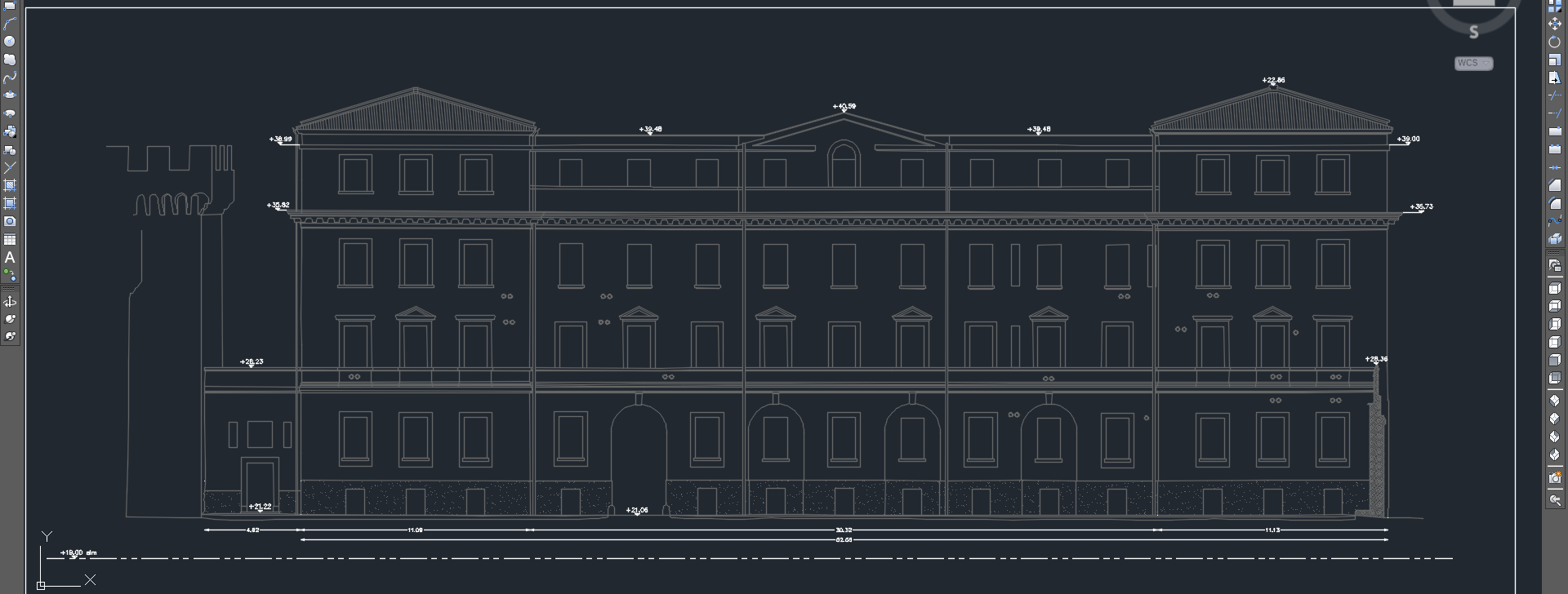
2d and 3d CAD model and documentation
Highly accurate floor plans sections and elevations can be generated in a variety of formats and levels of detail, tailored to suit your specific requirements.
Experience the difference with our team of highly skilled CAD engineers, who ensure all data processing takes place right within our premises.
We rely on industry-leading software, including Bentley Systems (Microstation, Bentley Descartes, Bentley Pointools, and ConextCapture), Riscan Pro (Riegl), Cyclone (Leica), AutoDesk Revit and Trimble Gedo Office for .


Our versatile services find their application in diverse fields, from industrial facilities, offshore installations, and marine vessels to architectural and railway projects, heritage preservation, and extensive urban regeneration endeavors.
Construction Verification
Elevate your project management with clash detection analysis. Whether it's design models or clouds, we compare and provide insights for agile decision-making.
CAD Drawing Services from Point Cloud Data
We specialize in creating accurate and detailed CAD drawings from the point cloud data provided by our clients.
Our team has a wealth of experience in transforming point cloud data into high-quality CAD designs.
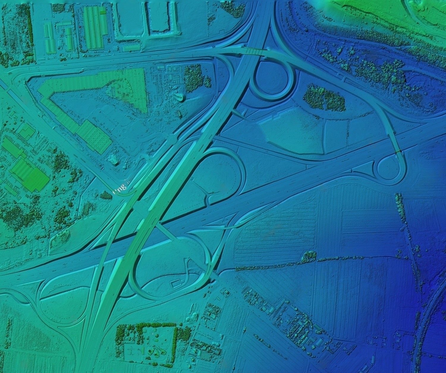
Contours line from LiDAR Point Cloud Data
We specialize in generating contours from LiDAR point cloud data, ensuring accuracy and detail in every aspect of your project.
Our team of professionals possesses extensive experience in converting LiDAR point cloud data into high-quality straight-line contours.

GLOSER FZ-LLC
A4-318 Building no.A4
Al Hamra Industrial Zone-FZ
RAK, United Arab Emirates
Licence 47009183
gloser.fz.llc@gmail.com
Copyright GLOSER FZ LLC